Nashville Declares Emergency Following Deadly Flooding
The Nashville Fire Department’s swift water rescue teams had pulled at least 130 people from vehicles and homes as of Sunday morning, the Nashville Office of Emergency Management said.
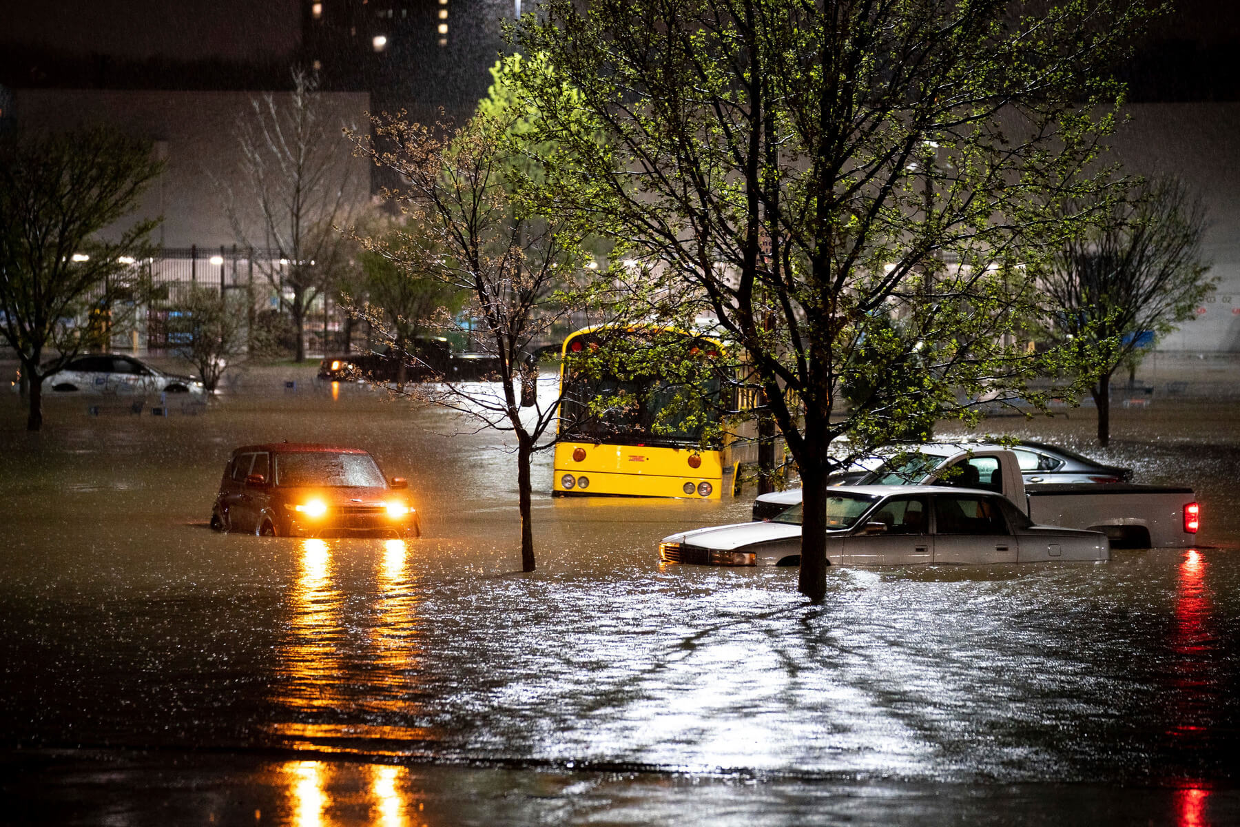
Search and rescue crews found a deceased man inside a car submerged by floodwater near a Walmart store next to a creek, the Metro Nashville Police Department said on Twitter. Officials later identified the man as Garry Cole, 70, of South Nashville.
The weather service earlier reported water entering a Walmart store in southern Nashville with cars in the parking lot submerged up to their windows.
A second man was found dead on the Nashboro Village golf course, police said. He was identified as 65-year-old Douglas Hammond, according to a tweet on the Metro Nashville Police Department’s (MNPD) verified Twitter account. Police characterized Hammond as an “apparent drowning victim,” and said he lived near the golf course.
Police believe Hammond was “swept away by flood waters after getting out of his car that had become stuck on Flintlock Ct,” near the Nashboro golf course, the MNPD said.
The bodies of a man, 64, and woman aged 46 were also found Sunday near a homeless camp adjacent to Wentworth-Caldwell Park, police said.
At least 15 people were rescued from an apartment complex after a building was damaged by a mudslide, the fire department said. Two of those rescued were taken to local hospitals with non-critical injuries.
The fire department said it also rescued about 40 dogs from a pet day care facility called Camp Bow Wow.
Rainfall totals across the middle Tennessee region since Saturday ranged from 4 to 8 inches, the NWS said. The Brentwood area of Nashville may have received 7 to 9 inches of rain, according to radar rainfall estimates.
The Nashville airport recorded at least 7 inches of rain since Saturday — making the two-day rainfall total the second-largest on record, trailing only 13.5 inches of rain that fell from May 1 to 2, 2010. More than 5 inches of rain fell between 10 p.m. local time Saturday and 5 a.m. Sunday, the NWS said.

The fast-falling rain inundated several rivers, creeks and streams, forcing them to breach their banks. Moderate-to-major river flooding was ongoing across the region.
The Cumberland River, which flows through downtown Nashville, was expected to reach its flood stage, which is 40 feet, just after 1 p.m. local time Sunday and peak at 41.9 feet shortly after midnight, according to Nashville Mayor John Cooper.
First responders are working with the Red Cross to walk creek beds and canvass affected neighbourhoods, Cooper said.
Mill Creek at Woodbine, on Nashville’s south side, crested at 20.8 feet, the second-highest level on record. “All the creeks and streams in southern Davidson County appear to have crested now and are falling,” according to the NWS office in Nashville. In Mount Juliet, an entire shopping center was submerged in water, according to a storm report from the weather service. Emergency personnel gather after responding to a call to help people stranded in the water on Antioch Pike in Nashville on Sunday.
Emergency personnel gather after responding to a call to help people stranded in the water on Antioch Pike in Nashville on Sunday.
Emergency personnel gather after responding to a call to help people stranded in the water on Antioch Pike in Nashville on Sunday.
“Roadways across the area are extremely dangerous, with many flooded,” Mount Juliet Police Capt. Tyler Chandler wrote on Twitter. “Please, if you are in a safe area, stay where you are. Do not travel, and definitely do not attempt to drive through flood waters. Our emergency responders are handling multiple incidents.” Another report said some residents were trapped in attics of their homes near Woodbine. The Metro Nashville Fire Department said early Sunday emergency crews were responding to residents impacted by the severe weather across the county.
In Williamson County, south of downtown Nashville, emergency crews responded to more than 34 swift water rescue calls from both vehicles and homes, Emergency Management Director Todd Horton said during a virtual news conference early Sunday. More than 50 roads were closed across the county.
Eight homes were struck by lightning during the storms, Horton said.
The Harpeth River at Franklin is rising and expected to crest at just less than 34.8 feet, the weather service said. “If that is accurate, it will reach a level that is about six inches less than the May 2010 flood, which was at 35.3 feet,” Horton said.
The Brentwood Fire Department was going door-to-door Sunday to check on residents who live near the Harpeth River, Brentwood City Manager Kirk Bednar said. Emergency officials conducted multiple water rescues of those trapped in their homes.
The flash flooding is expected to recede as the rain ends Sunday morning, but the river flooding will take more time to clear. Several rivers will not fall below flood stage for the next 24 to 48 hours.
The next chance for rain across Tennessee and Nashville will be from Tuesday night into Wednesday, Haley Brink said.
Flash flood watches are in effect for parts of surrounding states with more rainfall expected. The floods come just days after strong storms and tornadoes gripped parts of the South, killing at least six people. Rains from the earlier storm system have left the ground extremely saturated and rivers already swollen.

